Surveying Engineering Technology (SET)
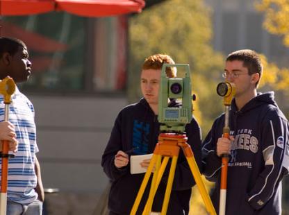
Surveying involves activities such as mapping the earth above and below sea level; determining the position of the boundaries of public or private land and providing geospatial information necessary for the construction of private and public works.
About the Program
A surveyor is a professional person with the academic qualifications and technical expertise to practice the science of measurement; to assemble and assess land and geographic related information; to use that information for the purpose of planning and implementing the efficient administration of the land, the sea and structures thereon; and to incite the advancement and development of such practices.
At NJIT, our curriculum stresses the technical, theoretical, and legal aspects of surveying, with a special emphasis on the case law to adequately perform a land survey and/or to aid judicial authorities in resolving boundary disputes.
NJIT’s Surveying Engineering Technology Program (B.S. Engineering Technology) is accredited by the Engineering Technology Accreditation Commission of ABET, http://www.abet.org., under the General Criteria and the Program Criteria for Surveying/Geomatics Engineering Technology and Similarly Named Programs.
Coordinator
Dr. Laramie Potts
Office: Fenster Hall 221
Phone: 973.596.8191
Email: lpotts@njit.edu
Program Faculty
Adjunct Faculty Employment Opportunities
Current employment opportunities can be viewed here.